Important info:
There are five permanent toilets at start. These are maintained by Oslo Kommune. It costs NOK 5/ EUR 0,43 to open the door. Tap card.
Start: 7 AM
If you can´t make it to 7AM, please note that the timing mat is there till 7:15. Luggage truck has to leave no later than 7:15.
Ultimate Sport Service only will be there till 7:15 - with unclaimed start numbers.
Cut off: 13h + 1 bonus hour = 14 hours
It is important that you understand this as a rule due to both safety and agreements we have with owners and Oslo Kommune.
The First Aid-crew with ambulance we have hired is also needed elsewhere. We can´t keep them forever.
The entire finisher area starts clearing from 8PM - the timing mat will be there till 9PM
It means very clearly: At 9PM the timing mat has left the area. :)
Remember to have a fully charged mobile - you need to send a text if you skip out of the race or if you realize you don´t make it to cut off.
Mobile numbers on bib.
--
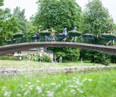
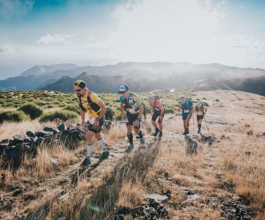
Ecotrail Oslo 80 km is a full-blown trail in the heart of the Norwegian capital. You will have the chance to explore both urban trails and forest trails. The course combines dirt roads and technical trail. And some asphalt.
You will be taken through historical areas that are now used for recreation, such as picnics, swimming, fishing, walking, running and cross-country skiing, and they will see the heart of the city.
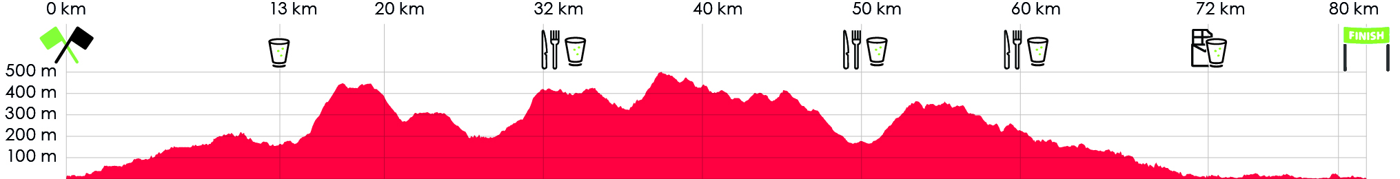
After approx 30km from start you will have a panorama view over Oslo on the peak called Vettakollen.
A few kilometers further on you can be impressed by Norway most popular tourist attaction Holmenkollen ski jump.
Then further to Sørkedalen area, a valley with farmers. After the support station in Sørkedalen you have 10 km throug the forest to Fossum support station.
After Fossum you hit the Lysaker River, with technical trails. The last 10km is by the Oslofjord - gravel roads + some asphalt. Finisher line by the beach at Huk, Bygdøy.
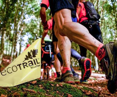
If wet conditions we recommend trail shoes. If dry, you´ll be fine with regular running shoes. Gravel roads, paths, technical paths and about 10 % asphalt.
CUT OFF TIMES AND LOCATION SUPPORT STATIONS
- Maridalen Kirke water/sportdrink Frist station for 80 km, after approx 13,4 km from start. Open 7:30- 9 AM . Water, sportsdrink
- Support station Holmenkollen (same area as 50km start) after 33 km from start. Closing 12PM. Water, sportsdrink, fruit, sweets
- Support station Sørkedalen (same area as 31km start) after 51 km from start, closing 4PM. Water, sportsdrink, bread, bouillon, fruit, sweets and more
- Support station Fossum (same area as 21km start) after 61 km from start. closing 5:30PM. Water, sportsdrink, bread, bouillon, fruit, sweets and more
- Water station Thaugland - for all distances - after approx 8,5 km before finish, closing 7PM. Water, sportsdrink, sweets.
- Bygdøy - (no support) last intermediate for all distancesr (5 km before finish) closing 7.30 PM
- Finish: 8PM. We accept timing till 9 PM. After approx 81-82 km from start. Water, sportsdrink and something to grab
- SUPPORT: Within the support stations only.
GPX FOR 2026 IS UPDATED.